


A strong winter storm began delivering a blast of snow, freezing rain and sleet across the country Friday, leaving thousands of passengers stranded.
Nearly 1,600 flights were canceled as the storm moved over much of the Upper Midwest, according to flight tracking site FlightAware.com.
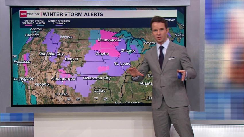
As of Friday afternoon, about 118 million people across the country were under some kind of winter storm warning, advisory or watch, CNN meteorologist Monica Garrett said.
Significant snow accumulations are likely in parts of Minnesota, northern Iowa, Wisconsin, Michigan and the interior Northeast.
“This has the potential to be one of the most impactful winter storms of the season for the Upper Midwest,” CNN meteorologist Taylor Ward said.
Motorists in Minnesota were seeing the early impacts of the storm. More than 120 car crashes were reported Friday evening, leaving 19 people injured, the Minnesota State Patrol tweeted.
The storm system will bring more travel misery on Saturday as it continues intensifying, the National Weather Service said.
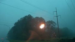
Ice prompted a temporary closure at Kansas City International Airport in Missouri, where a plane slid off the pavement, an airport spokesman said. There were no known injuries.
In Guymon, Oklahoma, the ice was so slick that resident Kassidy Stroup couldn’t stand up in her driveway. She shared a video of her futile struggle to open the door to her truck as she slid this way and that on the icy path.
Stroup planned to head into work later, she told CNN, after the ice had thawed a bit.
Jenni Pittman, who works for the National Weather Service, shared a time-lapse video of icicles forming off the roof of her home in Olathe, Kansas, on Friday morning.
Pittman was teleworking, she said, but her husband said the roads were “just barely passable.”
Here’s what to expect this weekend
Friday
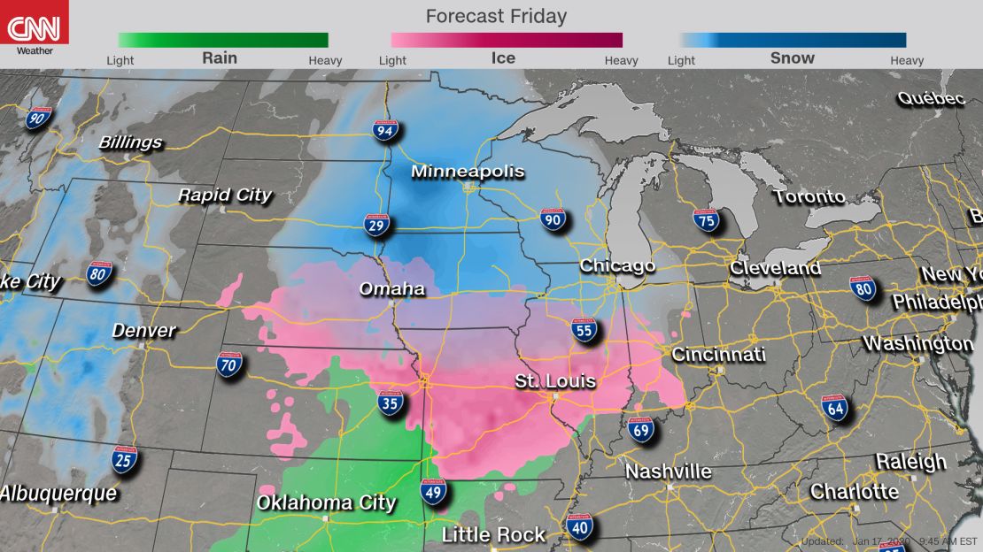
• A swath of locally heavy snow, sleet and freezing rain is expected for portions of the Central Plains northeast through the Upper Midwest, resulting in arduous travel.
• The Midwest could experience the highest snowfall totals. Minnesota, portions of Iowa, Michigan, Wisconsin and northern New England could see 8 to 12 inches of snow.
• These areas could experience blowing snow due to the high winds, which will cause near-whiteout conditions on roadways.
• The Rockies could see heavy snow, with wind gusts of up to 75 mph at lower elevations in the High Plains.
• Freezing rain accumulations are possible across portions of the Southern Plains and mid-Mississippi Valley. These icy conditions will make travel a problem in Oklahoma City, Kansas City and St. Louis. Accumulating ice will potentially knock down trees and power lines, causing numerous power outages.
• Air travel in the Midwest will most likely experience long delays and roads will be treacherous.
Get the latest extreme weather news
Saturday
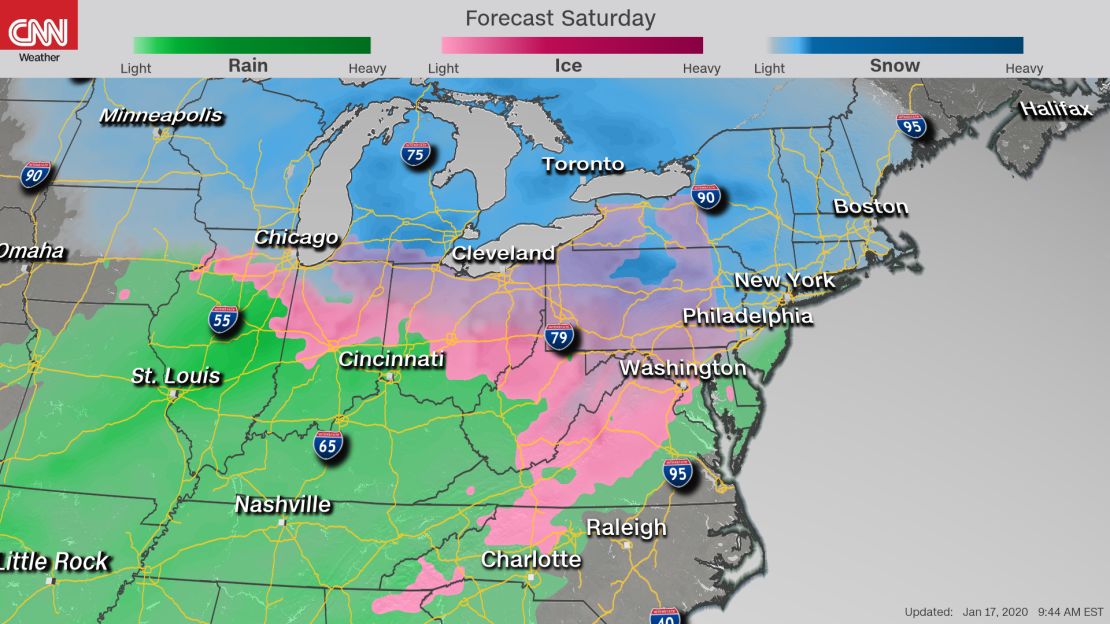
• Additional snow and ice accumulations will be possible into Sunday for interior portions of the Northeast and New England, with coastal areas first getting snow, then rain.
• New York City and Boston will get in the mix with snow in the afternoon. About 2 to 4 inches is possible for both cities. The snow will change over to rain in the evening, and it will rain overnight.
• Interior portions of the Northeast will see much more snow: 8 to 12 inches for Upstate New York and up to 6 inches in northern Maine.
“After the storm moves out, the bitter cold will settle in. High temperatures in the region will remain in the single digits Sunday and into the early part of next week, while overnight temperatures will dip to 10 to 20 degrees below zero,” according to Ward.
CNN’s Dakin Andone, Konstatin Toropin and Paul P. Murphy contributed to this report.